Navigating narrow mountain passes poses unique challenges for road-tripping recreational vehicles. Colorado’s notorious Wolf Creek Pass represents one such risky route where RVers should proceed with ample caution – or seek safer alternate paths. Stretching up to 10,850 feet elevation through the San Juan Mountains, the winding 25-mileWolf Creek Pass presents stunning alpine vistas.
However, traversing the Continental Divide along Highway 160 also requires extreme 6-7% ascending and descending grades. Hairpin curves hugging cliff sides, lack of guardrails, winter storms, and no exit points amplify risks. While the beautiful overlooks mesmerize, veteran overland drivers understand the dangers.
For most RVers, the potential thrill fails to justify exposure to shredded tires, crushed panels or damaged undercarriages if minor miscues mushroom into major mishaps. Fortunately, appealing and adventure-packed options avoiding Wolf Creek Pass’s hazards abound with savvier route planning.
Understanding Wolf Creek Pass
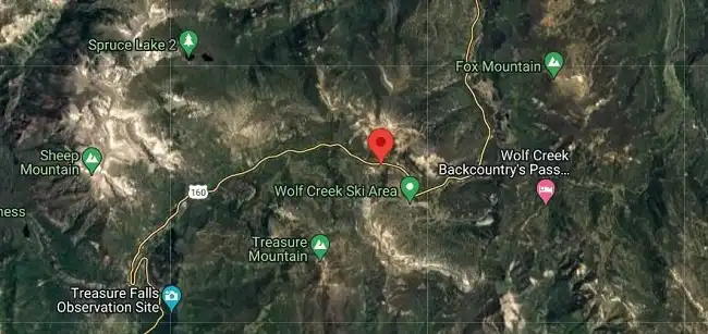
The Wolf Creek Pass is a high mountain pass located on US Highway 160 in southern Colorado. This remote pass reaches an elevation of 10,857 feet and provides an important route over the Continental Divide and San Juan Mountains between the San Luis Valley to the east and the town of Pagosa Springs to the west. However, its high altitude and winding path present major driving challenges, especially for recreational vehicles.
Geographical Location
Geographically, Wolf Creek Pass summits along the Continental Divide in southwest Colorado’s San Juan mountain range. It lies approximately halfway between the agricultural community of Del Norte on its eastern flank and the resort town of Pagosa Springs 25 miles to the west. US Highway 160 connects the two locales by winding through the formidable pass.
Topographical Challenges
The extreme topography of Wolf Creek Pass poses major porblems for overland travelers:
Steep Grades- Ascending from the San Luis Valley, Highway 160 features extended 6-7% eastbound climbing grades. Descending the western side, grades remain nearly as steep for trucks to carefully manage braking friction and heating.
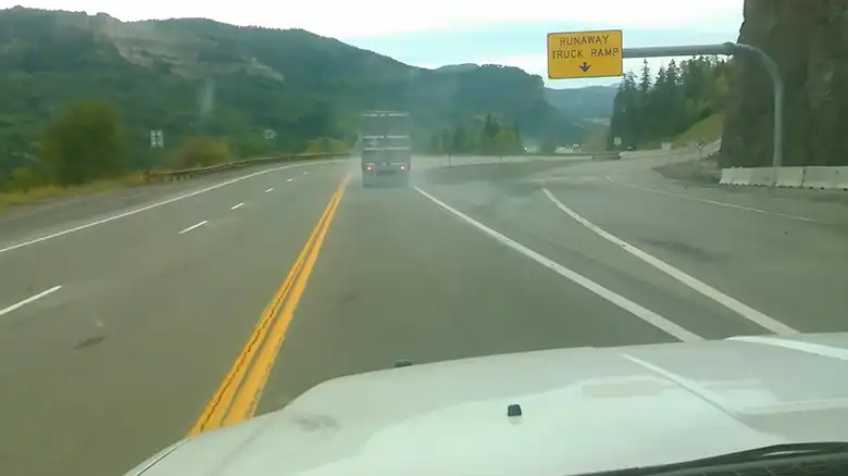
Sharp Turns- The highway twists through a series of hairpin switchbacks and constant curves hugging sheer mountain walls and cliffs. Limited sight lines, embankments close to the roadway edge, and lack of guardrails raise hazards.
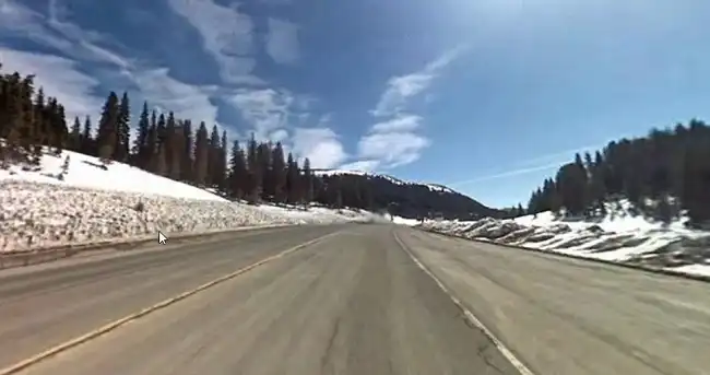
Weather Conditions- Harsh alpine conditions frequently impact the pass through howling winds, heavy snowfall shutting down the highway, and icy surfaces during winter months. Whiteout visibility during storms creates confusing, hazardous driving scenarios.
The challenging geography concentrates risks and precipitously fast changes in driving conditions across relatively short linear distances. Such factors demand alert drivers and well-prepared vehicles to safely cross Wolf Creek Pass.
Measuring the Distance of Wolf Creek Pass
Wolf Creek Pass extends approximately 25 miles from the entrance near Treasure Falls on the eastern side to the exit at Pagosa Springs on its western boundary.
While only 25 miles linearly, the passage requires much more driving distance and time to traverse safely due to the extreme elevation changes and constant hairpin switchbacks. The highway gains over 3,500 feet in elevation while crisscrossing the steep mountain terrain, necessitating cautious speed limits despite the short point-to-point mileage.
The moderate lengths belie the time required to safely ascend or descend the pass. Most vehicles require 45 minutes to an hour in ideal conditions driving between the pass’s eastern entrance and the summit overlook’s western side. Severe weather can dramatically lengthen drives. And the constant tight curves and steep grades make maintaining even slow speeds difficult across its entirety during hazardous conditions.
So while the short 25 miles fosters complacency for those unfamiliar, veteran drivers respect the prolonged transit times the challenging landscape mandates when negotiating Wolf Creek Pass. The topography remains the primary hurdle, not the mileage itself.
Risks RVers Face on Wolf Creek Pass
Traversing Wolf Creek Pass in an RV brings forth a set of inherent risks, necessitating a thorough understanding of historical incidents and RV-specific safety concerns.
Historical Incidents and Lessons for RVers
Historical incidents associated with Wolf Creek Pass serve as cautionary tales for RV travelers. Past accidents and challenges have highlighted the complexities of navigating this terrain. Drivers should learn from these experiences, recognizing the need for advanced skills and caution when maneuvering through the pass.
Essential Safety Considerations for RVs
1. Size and Maneuverability Challenges: The sheer size of RVs amplifies the difficulty of negotiating the pass’s twists and turns. Maneuvering through tight spaces becomes a daunting task, demanding precise control and spatial awareness. The risk of collisions with roadside obstacles or oncoming traffic is heightened, emphasizing the need for caution.
2. Weight Distribution Issues: Weight distribution issues in RVs not only affect stability but also impact braking efficiency. The added weight of an RV demands a well-maintained braking system to navigate the steep grades safely. Inadequate weight distribution can lead to brake overheating, diminishing their effectiveness and posing a significant safety risk.
The risks associated with Wolf Creek Pass for RVs encompass both historical incidents and RV-specific safety concerns. Size and maneuverability challenges, along with weight distribution issues, contribute to the complexity of navigating this pass. RVers must approach Wolf Creek Pass with heightened awareness, honed driving skills, and a commitment to addressing these specific challenges for a safer and more secure journey.
Estimated Travel Time Across Wolf Creek Pass
For recreational vehicles, the minimum 45 minutes often stretches towards an hour. Long wheelbases, widened turning radii, and high centers of gravity reduce agility and ability to quickly react to hazards. Adding precious minutes through the hairpin switchbacks and steep stretches bolsters safety margins. During hazardous conditions like winter storms or icy pavement, transit times can swell to multiple hours.
Wolf Creek Pass’s challenging geography and inconsistent, severe weather conditions combine to demand driving deliberation. Trying to blaze through the mountains risks paying an ultimate price. Allowing adequate time for the route’s demands grants the only reliable path to safely reaching your destination. So budget at least an hour, inform any expecting your arrival delays are likely, and always yield to the Pass’s commands. The mountains promise magnificent vistas if you embrace patience along with prudence.
Safer Routes for RVers to Avoid Wolf Creek Pass
RVers have several alternate route options to consider instead of running the risks posed by Wolf Creek Pass. Careful trip planning and taking RV-friendly roads through Colorado’s San Juan mountains allow overlanding adventurers to enjoy stunning alpine scenery without the harrowing grades and narrow switchbacks.
Planning RV-Friendly Scenic Routes
Modern technology provides an array of tools catering to RV-specific travel preferences when mapping less perilous journeys:
GPS Navigation for RVs: Specialized RV GPS units incorporate restrictions and hazards relevant to oversize vehicles. By inputting vehicle height, width, weight and other factors, the devices route drivers away from low overpasses, tight turns, steep mountains, and other obstacles.
Online Maps with RV Preferences: Websites and apps like RV LIFE Trip Wizard allow travelers to indicate RV-related needs from low clearances to generator accessibility. Their maps then suggest routes best tailored to the realities of maneuvering a large recreational vehicle.
Enhancing Communication and Alerts for RV Safety
Several regional highways snake through the San Juan mountains offering staggering vistas without Wolf Creek Pass’s acute hazards:
RV Parks and Campgrounds Along Alternate Routes: Roads including US-285 south from Poncha Springs, CO 149 passing Lake City, CO 17 into northern New Mexico and US 160 north all access legendary Coloradan beauty with numerous RV parks dotting their paths.
Highway Options Avoiding Steep Inclines: The paths above also circumvent the extremely steep 6-7% grades menacing Wolf Creek Pass. While still reaching high altitudes, their ascents prove more gradual and better suited to maintaining RV engine power and brake integrity.
With smart route selection, RVers can capture southwestern Colorado’s rich landscapes and adventures through rolling high plains and soaring peaks – all while avoiding unacceptable risks to their vehicles and passengers. Safe passage and spectacular scenery need not be mutually exclusive!
Emergency Preparedness Essentials for RVers
Staying connected and updated about changing road conditions provides vital trip support for RVers navigating remote mountain regions. Options tailored to RV travel help create awareness of hazards affecting oversize vehicles.
Understanding Regulations for RV Travel
CB radios remain essential tech enabling RVers to broadcast needs and listen for alerts from fellow travelers about trouble spots. Most RVs feature pre-wired coax ports for installing high-mounted CB antennas optimized for sending and receiving signals while mobile. RVers can warn others of risks found ahead or receive fair warnings of approaching mountain fog or accident delays to improve safety.
Mobile Apps for RVers
Smartphone apps catering to RVers also enhance real-time situational awareness regarding route obstacles and emergency support:
RVing Community Apps: User crowdsourced apps like RV Life and iExit provide details on low hanging signs or canopies, dump station closures, camping sites and other key points relevant to oversize RV travel needs not reflected in standard mapping tools.
Emergency Services Contact Apps: Apps like Help! I Crashed auto-share GPS coordinates to simplify contacting first responders, roadside assistance services, or vehicle repair providers quickly if disabled. Such tools prove invaluable along desolate stretches.
When exploring off the beaten path, RVers rely on technologies purpose-built to convey road risks and reach emergency assistance unique to the overlanding community. Remaining informed and connected mitigates the inherent uncertainties of navigating the open road and wilderness while living untethered beyond the grid.
Emergency Preparedness for RVers on the Wolf Creek Pass
Starting on the scenic Wolf Creek Pass journey demands not only admiration for nature but also meticulous emergency preparedness for RVers. Beyond the awe-inspiring landscapes, understanding the essentials, like an RV-specific first aid kit and emergency contacts, can make all the difference in ensuring a secure and enjoyable expedition.
A. RV-Specific First Aid Kit
Comprehensive Supplies: Equip your RV with a well-stocked first aid kit tailored to address common travel injuries. Include bandages, antiseptics, pain relievers, and any prescription medications.
Medical History Documentation: Keep essential medical information, including allergies and existing conditions, in the first aid kit. This aids emergency responders in providing efficient care.
B. Emergency Contacts
1. RV Roadside Assistance:
- 24/7 Helpline: Subscribe to an RV roadside assistance service with a 24/7 helpline to receive prompt support for breakdowns, flat tires, or mechanical issues.
- Know the Procedure: Familiarize yourself with the procedures for accessing assistance, ensuring a quick response during emergencies.
2. Local Authorities:
- Save Local Emergency Numbers: Have local emergency numbers saved in your contacts for immediate access to local authorities in case of accidents or other emergencies.
- Communicate Effectively: Clearly communicate your location, situation, and specific needs when reaching out to local authorities.
Being prepared for emergencies on the Wolf Creek Pass involves two key elements: having an RV-specific first aid kit with comprehensive supplies and documentation, and maintaining emergency contacts, including RV roadside assistance and local authorities. These measures empower RVers to handle unexpected situations effectively, fostering a safer and more enjoyable journey through this captivating pass.
Regulatory Considerations for RV Travel
RV travel is subject to various regulations, varying by jurisdiction. Compliance ensures safety and legal adherence. Regulations may encompass camping restrictions, speed limits for larger vehicles, and specific rules for RV parking. Familiarize yourself with the rules in each area you explore to avoid legal complications and promote responsible travel practices.
A. Compliance with RV Regulations
RV travelers must be well-versed in and comply with a myriad of regulations specific to their mode of travel. These regulations can vary across jurisdictions and may encompass camping restrictions, speed limits tailored for larger vehicles, and rules regarding RV parking. Understanding and adhering to these regulations is essential to prevent legal complications and promote responsible travel practices.
B. Size and Weight Restrictions for RVs
Know Your RV’s Specifications: Be aware of your RV’s dimensions, weight, and height.
Bridge and Tunnel Restrictions: Understand size limitations, especially regarding low-clearance bridges and tunnels.
National and State Regulations: Different states may have unique regulations; research and adhere to them for a seamless journey.
Regulatory considerations for RV travel involve two primary aspects: compliance with specific RV regulations in each region and adherence to size and weight limitations. By incorporating these considerations into travel plans, RVers not only ensure a hassle-free journey but also contribute to overall safety and responsible travel practices.
Questions and Answers (Q&A)
Q1: Are there alternative routes to Wolf Creek Pass suitable for RVs?
A: Yes, explore RV-friendly routes, prioritizing GPS navigation and online maps tailored for RV specifications.
Q2: What challenges do RVers face on Wolf Creek Pass?
A: RVers encounter steep grades, sharp turns, and unpredictable weather, necessitating advanced driving skills and caution.
Q3: How can I communicate with other RVers while avoiding Wolf Creek Pass?
A: Utilize RV community apps for real-time advice and updates, fostering communication within the RV community.
Q4: Is it necessary to check weather conditions before planning to avoid Wolf Creek Pass?
A: Absolutely, stay informed about real-time weather updates, especially during winter, to ensure a safer journey.
Q5: Why is compliance with RV regulations important when planning to avoid Wolf Creek Pass?
A: Ensuring compliance with regulations is crucial for legal adherence and a seamless journey, preventing potential complications.
Summing Up
Avoiding Wolf Creek Pass in your RV is not just a matter of convenience but a crucial step towards ensuring a safe and enjoyable journey. Prioritize RV-specific route planning, stay connected with communication tools, and be prepared for emergencies. Safe travels!