Hitting the open road in an RV is an exhilarating experience, filled with the promise of adventure and the joy of exploration. However, navigating the vast expanse of highways and byways with your home on wheels presents unique challenges. Ensuring safe and seamless travel is paramount, and one of the most critical elements is having a reliable navigation system that caters to the specific needs of RV travelers.
The question on many RVers’ minds is: Does Google Maps have an RV setting? The answer, unfortunately, is no. Google does not provide routes that are safe for RVs. Google Maps, while a powerful navigation tool, lacks a dedicated RV mode that takes into account the unique specifications of larger recreational vehicles. This can potentially lead to unexpected obstacles, such as low bridges, narrow roads, or weight-restricted areas, which could jeopardize the safety and enjoyment of your journey.
Why RV-Specific Navigation is Essential for Safe Travel
RVs are significantly larger and heavier than standard passenger vehicles, making it crucial to consider factors like vehicle height, width, weight limits, and turn radius when planning routes. Failing to account for these specifications can lead to dangerous situations, such as getting stuck under a low bridge or being unable to navigate narrow, winding roads.
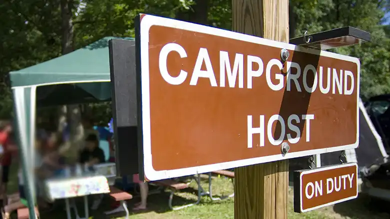
Additionally, RVers often prioritize finding suitable campgrounds, rest stops, and dump stations along their routes, which may not be readily available or easily identifiable on standard navigation apps.
Top Alternatives to Google Maps for RV Road Trips
While Google Maps doesn’t offer an RV setting, there are alternative solutions and workarounds that can help ensure a safe and enjoyable RV travel experience.
RV Trip Wizard: A Tailored App for Safe Travel

Designed specifically for RV travelers, the RV Trip Wizard app offers a user-friendly interface that simplifies trip planning. One of its key features is the ability to input your RV’s dimensions (height, width, length, weight), allowing the app to find routes that are suitable for your vehicle, avoiding low bridges, narrow roads, and weight-restricted areas.
The app also provides a range of additional functionalities to enhance your RV travel experience, including:
- Multi-stop routing: Plan trips with multiple destinations, optimizing routes that consider your RV’s specifications.
- RV park suggestions: Find RV campgrounds along your route that cater to your needs, including filtering by amenities like full hookups or big rig-friendly locations.
- Trip editing tools: Easily adjust your route as needed, allowing for spontaneous changes or last-minute additions.
- Real-time traffic updates: Stay informed about current traffic conditions to avoid delays and adjust your route accordingly.
- Offline maps (with premium subscription): Download maps for areas with limited cell service, ensuring continued navigation even in remote locations.
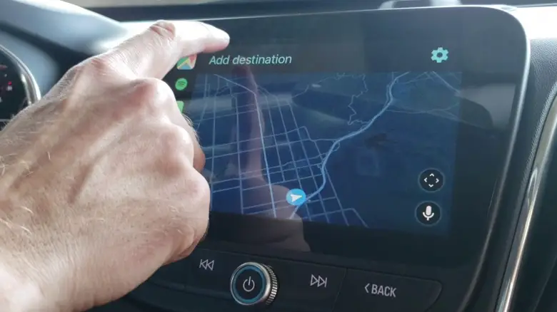
How to Customize Google Maps for Your RV Journey
While Google Maps doesn’t have a built-in RV mode, you can create a custom map tailored to your RV travel needs. Start by creating a new map on Google Maps and personalize it for your trip. Utilize search functions to find and add RV campgrounds and points of interest relevant to your travel needs, using keywords like “RV park,” “full hookup campground,” “dump station,” or “rest area for RVs.”
Additionally, user-generated content can be valuable. Look for campgrounds with reviews mentioning they are RV-friendly and spacious. Resources like RVlife.com can provide comprehensive campground listings.
Once you’ve identified suitable locations, add them as markers to your custom map. You can further personalize your map by adding notes, photos, or route waypoints.
Specialized RV GPS Devices: A Better Option for RVers
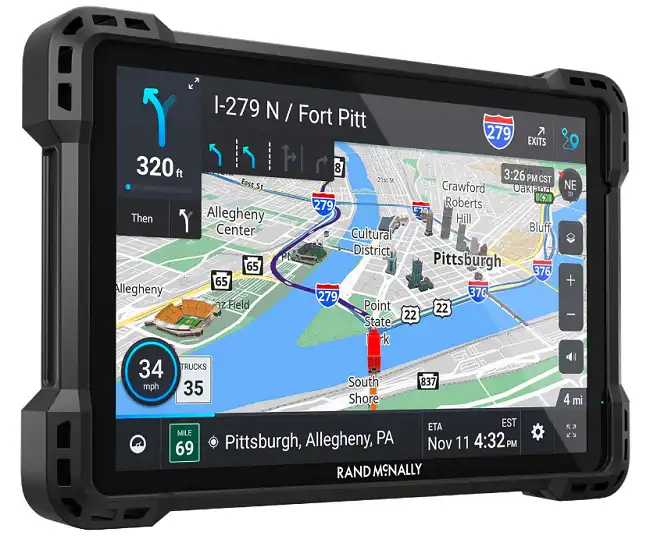
Dedicated RV GPS devices offer a robust solution for RV navigation. These devices typically come pre-loaded with maps specifically designed for RVs, considering factors like road width, height clearances, and weight limits. Built-in RV-friendly routes help you avoid getting stuck on unsuitable roads.
Many RV GPS devices also boast a wealth of RV-specific points of interest (POIs), including campgrounds with tall clearances, dump stations, and rest areas suitable for larger vehicles. An additional advantage is having pre-downloaded maps for areas with potentially limited cell service, ensuring continued navigation even in remote locations.
Maximizing Google Maps Features for RV Navigation
While Google Maps may not have an RV-specific setting, you can still leverage its features to enhance your RV travel experience. Here are some tips and strategies:
- Search for RV-friendly resources
Use keywords and filters to search for RV campgrounds and rest stops along your planned route. Look for terms like “RV park,” “full hookup,” or “dump station.” User-generated content with reviews mentioning suitability for RVs can be valuable.
- Utilize traffic and satellite view features
Assess road conditions beforehand using the traffic layer to identify congestion and the satellite view to spot potential issues like low bridges or narrow roads.
- Consider user reviews and ratings
Consult user reviews and ratings for campgrounds and points of interest to gain insights on suitability for RVs. Look for mentions of tight turns, low clearances, or other potential challenges.
- Plan for potential lack of cell service
Download offline maps for critical areas or explore third-party navigation apps with robust offline functionality to ensure continued navigation in areas with limited connectivity.
- Import Trip Maps from RV Trip Wizard
If you’ve planned your trip using the RV Trip Wizard app, you can import the trip map into Google Maps for navigation. Simply download the .gpx file from the app’s “GPS Export” menu, then import it into Google My Maps on your computer. This will sync the map with your mobile device, allowing you to access the RV-friendly route on Google Maps.
Here are the steps to import your trip map from RV Trip Wizard to Google Maps:
- Download the .gpx file from the “GPS Export” menu in RV Trip Wizard.
- Open Google My Maps on your computer and create a new map.
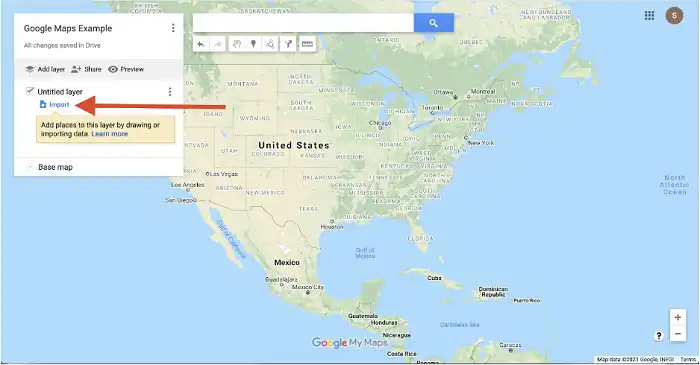
Importing downloaded map on your Google Maps
- Click the “Import” button and select the downloaded .gpx file.
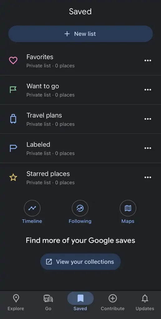
Finding saved maps on your Android or iOS device with Google Maps
- The trip map will be imported, and you can access it on Google Maps via the “Saved” section on your mobile device.
By importing your RV Trip Wizard planned route into Google Maps, you can leverage the app’s RV-specific route optimization while still using the familiar Google Maps interface for navigation.
End Notes
While Google Maps doesn’t have a dedicated RV setting, there are alternative solutions and workarounds available for safe RV navigation. Utilizing tools like the RV Trip Wizard app, creating custom maps, or investing in a specialized RV GPS device can help ensure a smooth and enjoyable RV travel experience.
Remember, proper planning and accounting for your RV’s specifications are crucial for avoiding potential hazards and ensuring a stress-free journey. Take the time to explore the mentioned RV trip planning options, download offline maps for critical areas, or consider a specialized RV GPS device if you’re a frequent RV traveler. With the right tools and preparation, you can confidently navigate the open road, creating lasting memories and enjoying the freedom of RV life.